Tropical Update: Tropical Storm Kiko Forms in the Pacific

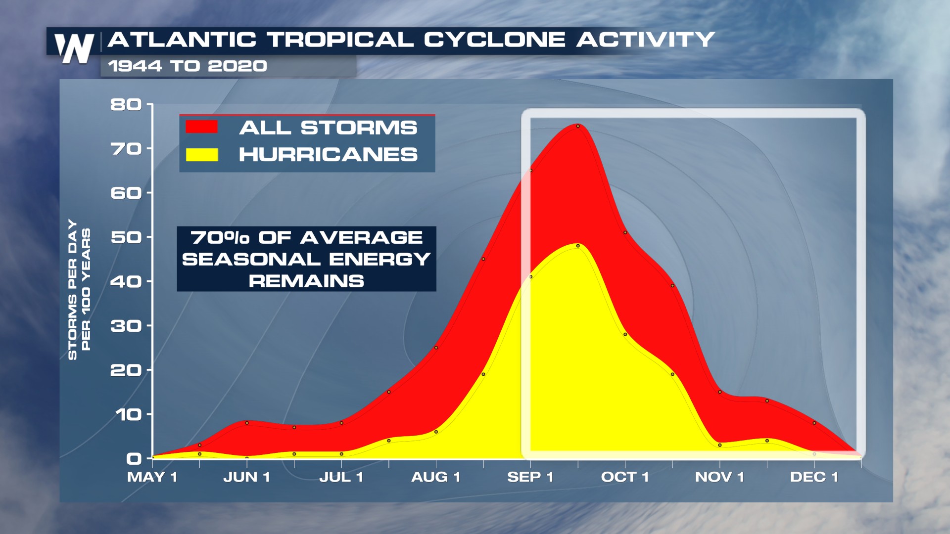
As we near the peak of the 2025 Atlantic hurricane season, one question on many minds is "Why has it been so quiet?" About two-thirds of all Atlantic hurricane activity typically occurs between August 20th and October 10th. With only a handful of named storms and only one major hurricane through late August, the sluggish pace stands in stark contrast to what many seasonal forecasts had warned would be an active year. So, what's causing the delay?
Several key factors are at play in this slow start. First, the Main Development Region (MDR) of the tropical Atlantic, where most storms form during peak season, has been cooler than expected. While still slightly above average, it falls short of the record-breaking warmth seen in 2024. Meanwhile, waters in the subtropical Atlantic are significantly warmer, disrupting the usual energy gradient that helps fuel storm formation.
Atmospheric conditions have also been unusually hostile to storms. Persistent wind shear across the Gulf and Caribbean has torn apart developing systems before they can organize. On top of that, the upper atmosphere has remained unusually warm and stable, effectively placing a lid on the kind of deep convection hurricanes need to grow. Add in frequent plumes of dry, dusty air from the Sahara, and the result is a storm-suppressing cocktail that’s kept the basin eerily calm.
Next Few Weeks
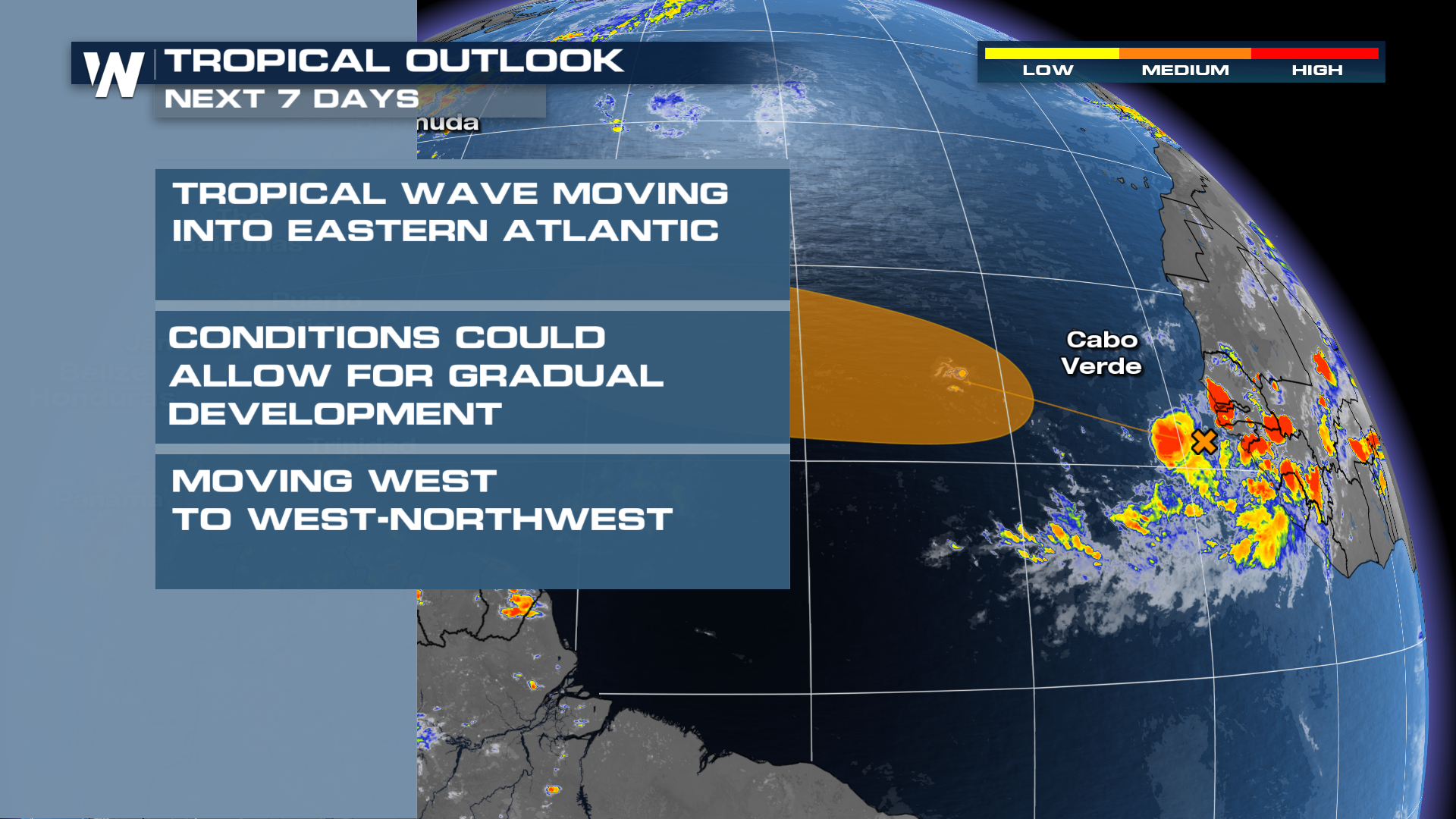
Do not let your guard down. The National Hurricane Center has issued an outlook for a wave off the coast of Africa. The area of disorganized showers and thunderstorms is supposed to emerge off the coast of Africa this weekend, and the NHC is giving it a 40 percent chance of development in the next 7 days.
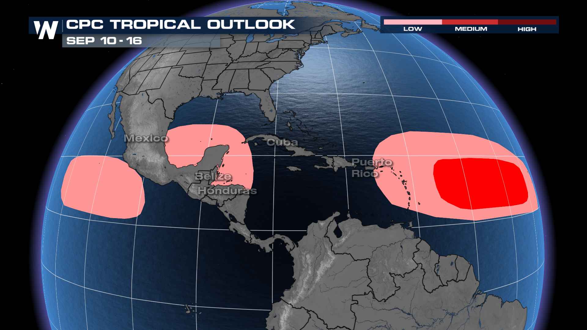
 All it takes is one hurricane to make it a memorable season. The tropics in the Atlantic have a chance to stay active through the first week of September, heading into the second week. While a large-scale Kelvin Wave is not likely to spur activity like it has over the last two weeks, additional tropical waves could develop in the Atlantic and the Gulf/Western Caribbean. During this time of year, any development will need to be monitored closely.
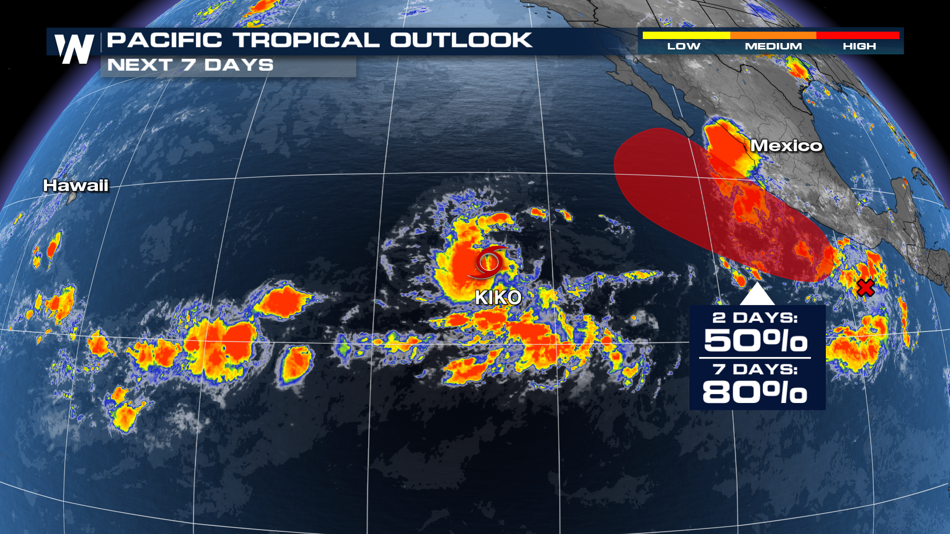
Eastern Pacific
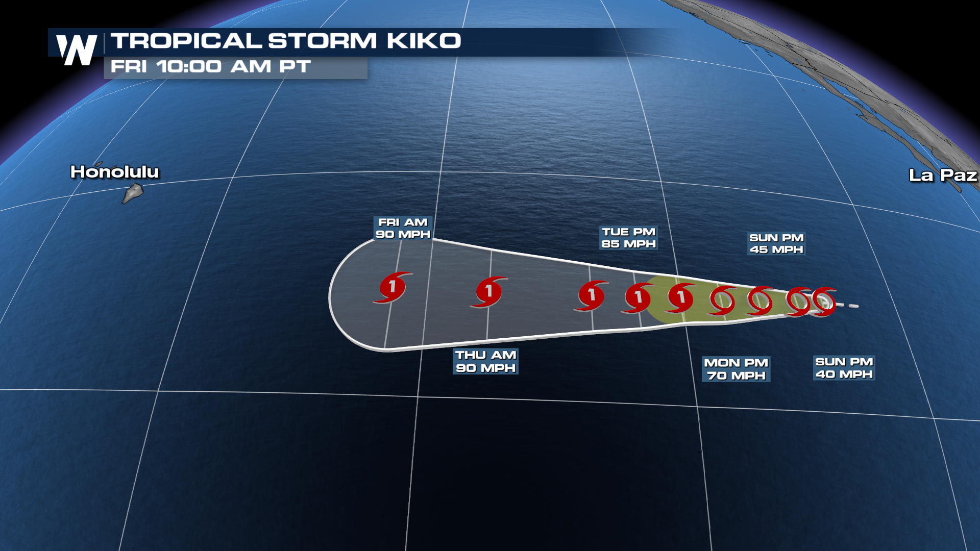
The Eastern Pacific has been pretty active again, with two areas of interest. As of Sunday morning, the western wave was officially dubbed Tropical Storm Kiko.
The wave behind it may need to be monitored more closely, as some forecast models bring its remnant moisture back into the southwestern U.S. in the long range (10-14 days).
Stay with WeatherNation for the latest.


